Nice large grape vine. That thing is 10 or more years oldUnfortunately these were all taken with my phone and I'm not expert at that. Would love to start taking some photos with my real camera that I can post too.
View attachment 153880 I like this one because the root looks like a monkey trying to get away.
Smoky Mountains
You are using an out of date browser. It may not display this or other websites correctly.
You should upgrade or use an alternative browser.
You should upgrade or use an alternative browser.
Post A Photo, A Real Photo
- Thread starter Sentry18
- Start date


Help Support Homesteading & Country Living Forum:
This site may earn a commission from merchant affiliate
links, including eBay, Amazon, and others.
We visited Munising while doing the circle tour around Lake Superior. That was one of our favorite stops. Did the boat cruise out by pictured rocks. Awesome placeWhen I turned 21 I was living in Munising Michigan, 2 blocks off Lake Superior and next to the inland light house. I didn't take these photos, but I did live in a house just on the left at the end of the road. We had to put in the hot water heater, and 1972 the old house cost $6, 300 and the payments were $70 a month. Going from the South to Munising was a shock as it was getting 200 inches of snow in the winter (Sept - May). I loved it. It took 30 minutes to walk all the way across town. Very safe.
This is the light house I lived adjacent to , and would watch snow fall through the red beam when in bed in the winter. And M28 between Munising and Marquette is /was wonderful. There were no casinos or anything like that.
View attachment 153869
View attachment 153870
We use to park the car where that red one was.
- Joined
- Oct 2, 2021
- Messages
- 1,350
You're not monopolizing anything. Your pictures are good, so keep going.Do more of you have photos of where you've lived or travelled? I don't want to monopolize this thread.


- Joined
- Aug 25, 2020
- Messages
- 857
Thats nothing new , we had the hippie movement in the 60s . they were the beginning ....have you met the current generation that will replace us?


$6.99 ($1.75 / Count)
$12.99 ($3.25 / Count)
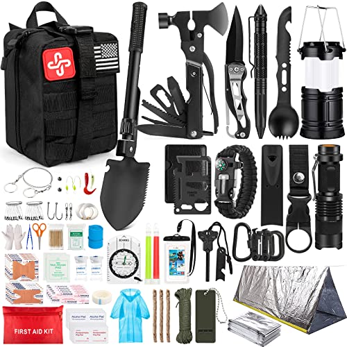
QIO CHUANG Emergency Mylar Thermal Blankets -Space Blanket Survival kit Camping Blanket (4-Pack). Perfect for Outdoors, Hiking, Survival, Bug Out Bag ,Marathons or First Aid 1
Qio chuang

$189.99
$205.99
RomoTech 82123919 Horizontal Square Reservoir Water Tank, 50 gallon, Made In The USA, Poly Tank For Water and Non-Flammable Liquids, Rust and Corrosion Proof
Northern Tool + Equipment


$10.69
$16.99
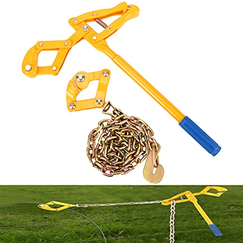
allsun Electric Fence Voltage Tester Fault Finder Farming Equipment Portable Testing Tool Neon Lights Max 600V-7000 V
Global Meter

$22.35
$26.99
7 Rules of Self-Reliance: How to Stay Low, Keep Moving, Invest in Yourself, and Own Your Future
Amazon.com


$39.95 ($13.32 / Count)
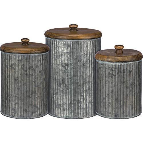
Red Co. Set of 3 Pre-Labeled Sugar, Coffee & Flour Distressed Metal Storage Canister Jars with Wooden Lids
Red Co Products (US Seller)


$67.42
$88.15
Primitives by Kathy Rustic Style Canisters, Set of 3, Galvanized Metal and Wood
MI Shopping Deals


This Carl has rich colors:

Their proper name is coral, but I call them 'Carl' because they have a long dong.
Their proper name is coral, but I call them 'Carl' because they have a long dong.
Last edited:
...have you met the current generation that will replace us?
In a few short years, they too will be hearing their protest music played in elevators. It is the Otis cycle of life.
Would you believe, when I get the stocks I inherited, I will actually be a stockholder in them?In a few short years, they too will be hearing their protest music played in elevators. It is the Otis cycle of life.


Last edited:
Would you believe, when I get the stocks I inherited, I will actually be a stockholder in them?
Use your shareholders vote to bring back 70's rock-n-roll to elevators!
I never knew they were so big into escalators...Use your shareholders vote to bring back 70's rock-n-roll to elevators!
Wiki:
Seville Square - Pensacola Florida They were having a craft fair set up.

The pier at Pensacola Beach - sunset, hyper color turned on the camera.

- Joined
- Dec 20, 2017
- Messages
- 15,678

A friend and his little girl, about 25 years ago, pencil drawing taken from a photo.


- Joined
- Feb 12, 2020
- Messages
- 4,279
In my pump house
Before:

After:

It's obviously still not done. Need to add more conduit. Didn't have enough to run it where we needed. Also need to put in the GFI outlet and put the weatherproof cover on just in case. The roof tends to leak a bit.
More of my 4 o'clocks.


And other flowers-- don't know what kind.

Before:
After:
It's obviously still not done. Need to add more conduit. Didn't have enough to run it where we needed. Also need to put in the GFI outlet and put the weatherproof cover on just in case. The roof tends to leak a bit.
More of my 4 o'clocks.
And other flowers-- don't know what kind.
Badger... always the clown.

- Joined
- Oct 2, 2021
- Messages
- 1,350


That's not a lake. It's a fifty foot wide river that has been flooding here in Spencer, Iowa. It's a nice view when you're eating at the restaurant or in the bar area but a lot of that is park and campground area.
This is outside of a public library that has a no weapons policy.

@d_marsh Neat idea that I don't see being utilized. I would just get more kindle books and keep my possessions with me.
Plus free guns for anyone who doesn't obey the law. Which I guess would be people like me cuz I would carry my gun right into that library.
...Only in Illinoize.
Saves them the trouble of putting up their sign that says: "Only unarmed victims inside! Have fun!
 ".
".Disgusting violation of our 2A.
Edit: Sorry, forgot the required disgusting picture
:
Last edited:

...Only in Illinoize.
Saves them the trouble of putting up their sign that says: "Only unarmed victims inside! Have fun!
Disgusting violation of our 2A.
Edit: Sorry, forgot the required disgusting picture
Meanwhile, in Texas....
Much better!


- Joined
- Dec 3, 2017
- Messages
- 21,378
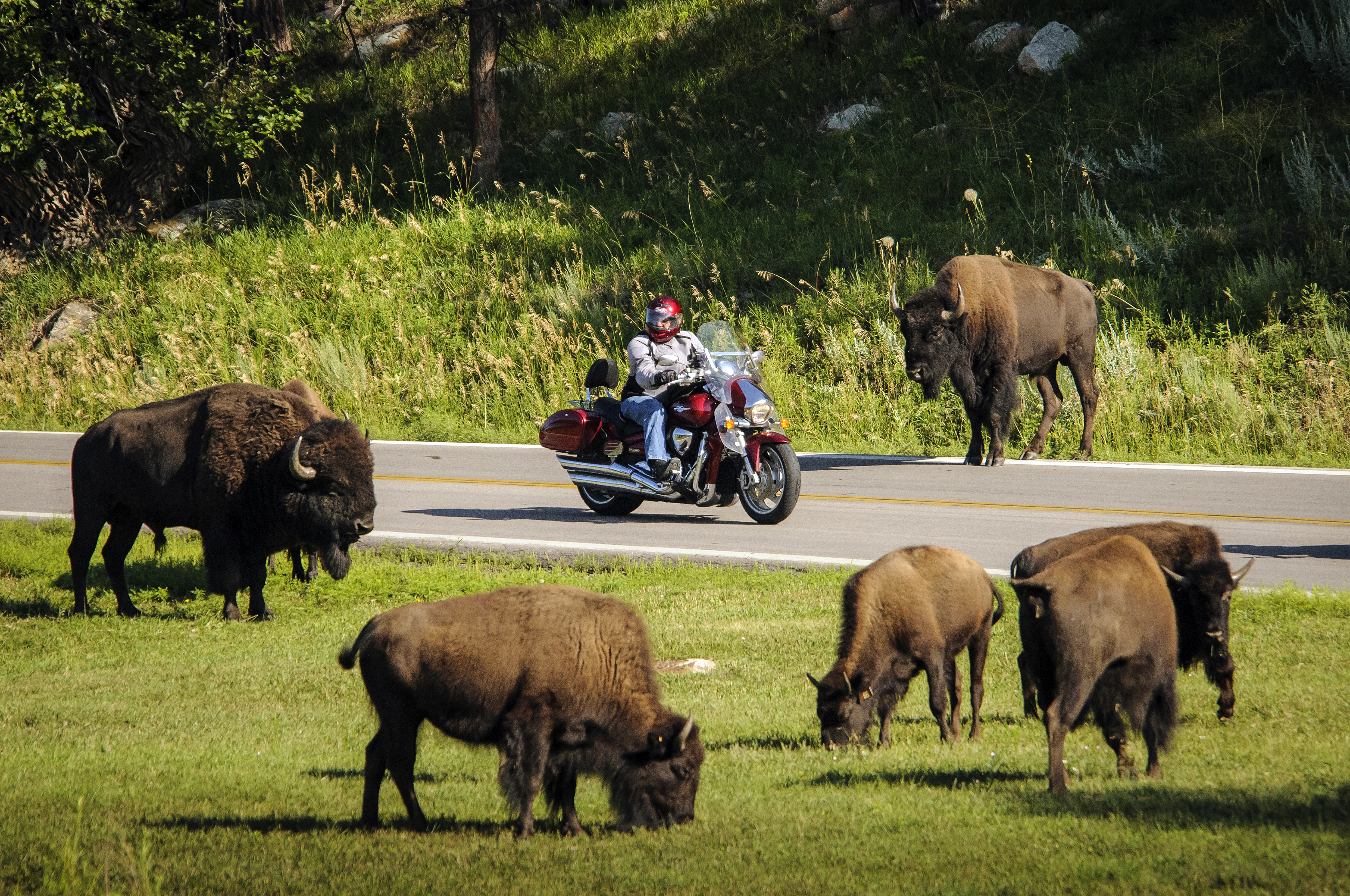
Passing the Needles Eye Tunnel in the Black Hills, South Dakota, US.

I remember driving through that. It was an awesome area. I want to go back!
- Joined
- Dec 20, 2017
- Messages
- 15,678
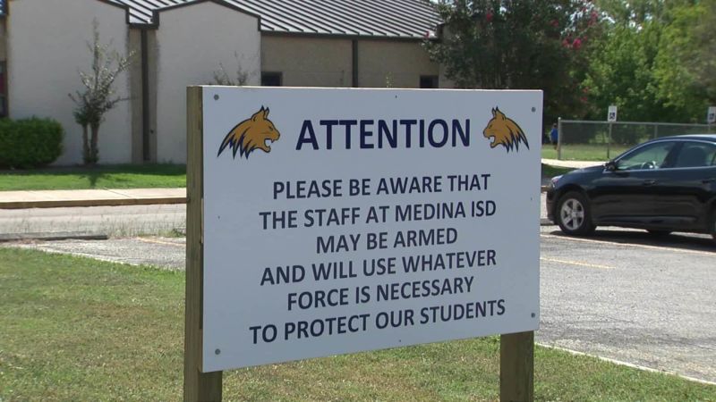
@Supervisor42 it is true that you might see signs like that outside of Texas schools. My grandchildren's school district is like that. I haven't heard about anyone complaining.
Yep.@Supervisor42 it is true that you might see signs like that outside of Texas schools. My grandchildren's school district is like that. I haven't heard about anyone complaining.
Better picture without the word 'may' and with the word 'are':

God bless Texas!!!

I know a gal who said if her youngest boy was still in school HE WOULD HAVE THAT TEACHER'S GUN!! That boy is in prison for the rest of his life! Not ALL teachers can handle having a gun!!Yep.
Better picture without the word 'may' and with the word 'are':
God bless Texas!!!
- Joined
- Dec 3, 2017
- Messages
- 21,378
There are some very fun roads to drive in the Black Hills. Whoever did the engineering on them made them fun. There is a highway called the pig tail.I remember driving through that. It was an awesome area. I want to go back!
https://gfp.sd.gov/csp-scenic-drives/
Scenic drives through Custer State Park
Needles Highway
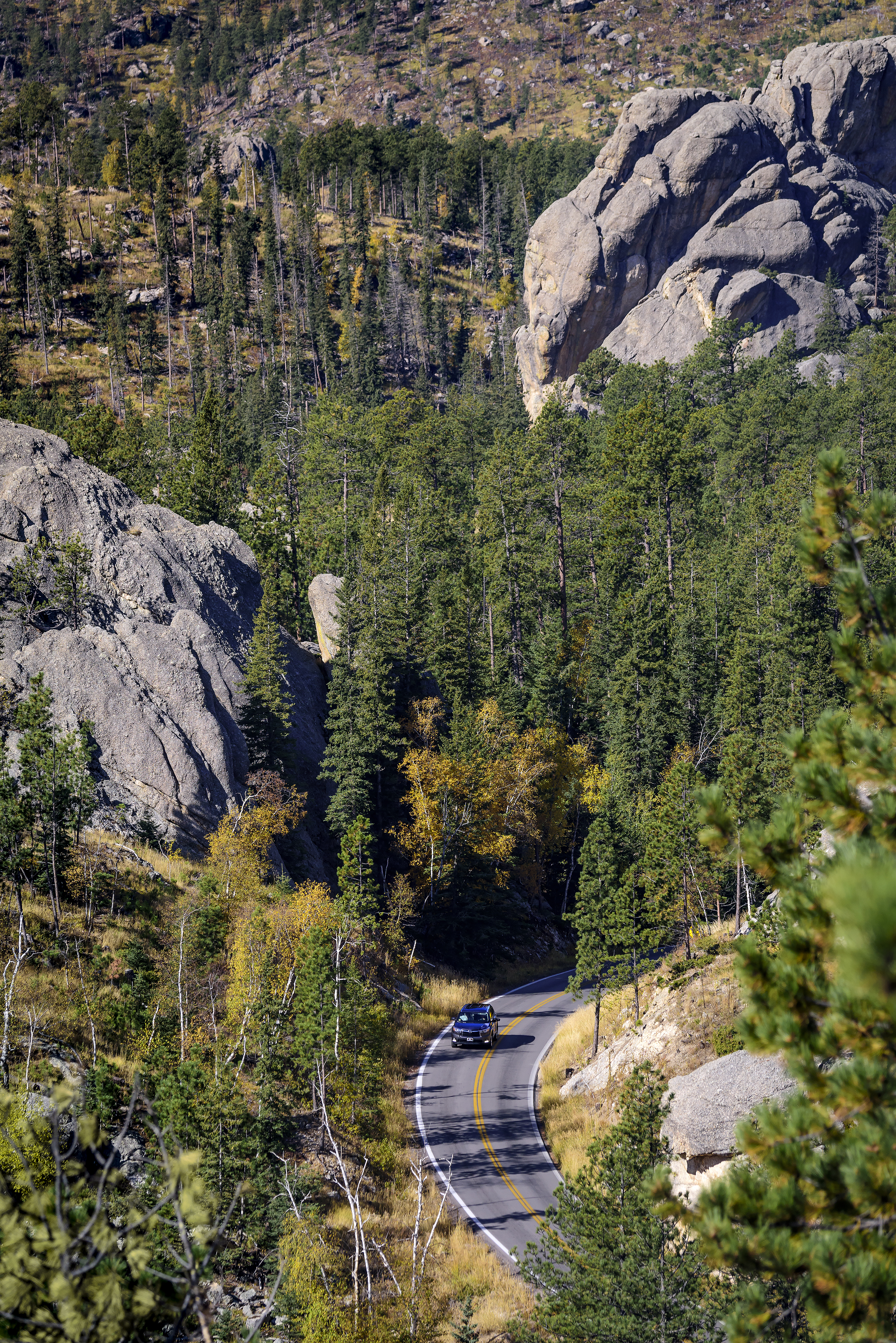
(SD Hwy 87 North)
Distance: 14 miles
Expected travel time: 60+ minutes
Tunnels:
Needles Eye Tunnel (Near Needle's Eye), 8' 0" wide by 9’9" high;
Iron Creek Tunnel, 8' 9" wide by 10’10” high.
The Needles Highway is a spectacular drive through ponderosa pine and Black Hills spruce forests, meadows surrounded by birch and aspen, and rugged granite mountains.
The road's name comes from the needle-like granite formations, which seem to pierce the horizon along the highway.
The roadway was carefully planned by former South Dakota Governor Peter Norbeck, who marked the entire course on foot and by horseback. Construction was completed in 1922.
Visitors traveling the highway pass Sylvan Lake and a unique rock formation called the Needle's Eye, named for the opening eroded by wind, rain, freezing, and thawing.
Needles Highway closes to vehicles with the first snow of the season and does not reopen until April 1, or later depending on conditions. The trail remains open for hikers, walkers, bikers and skiers.
Iron Mountain Road
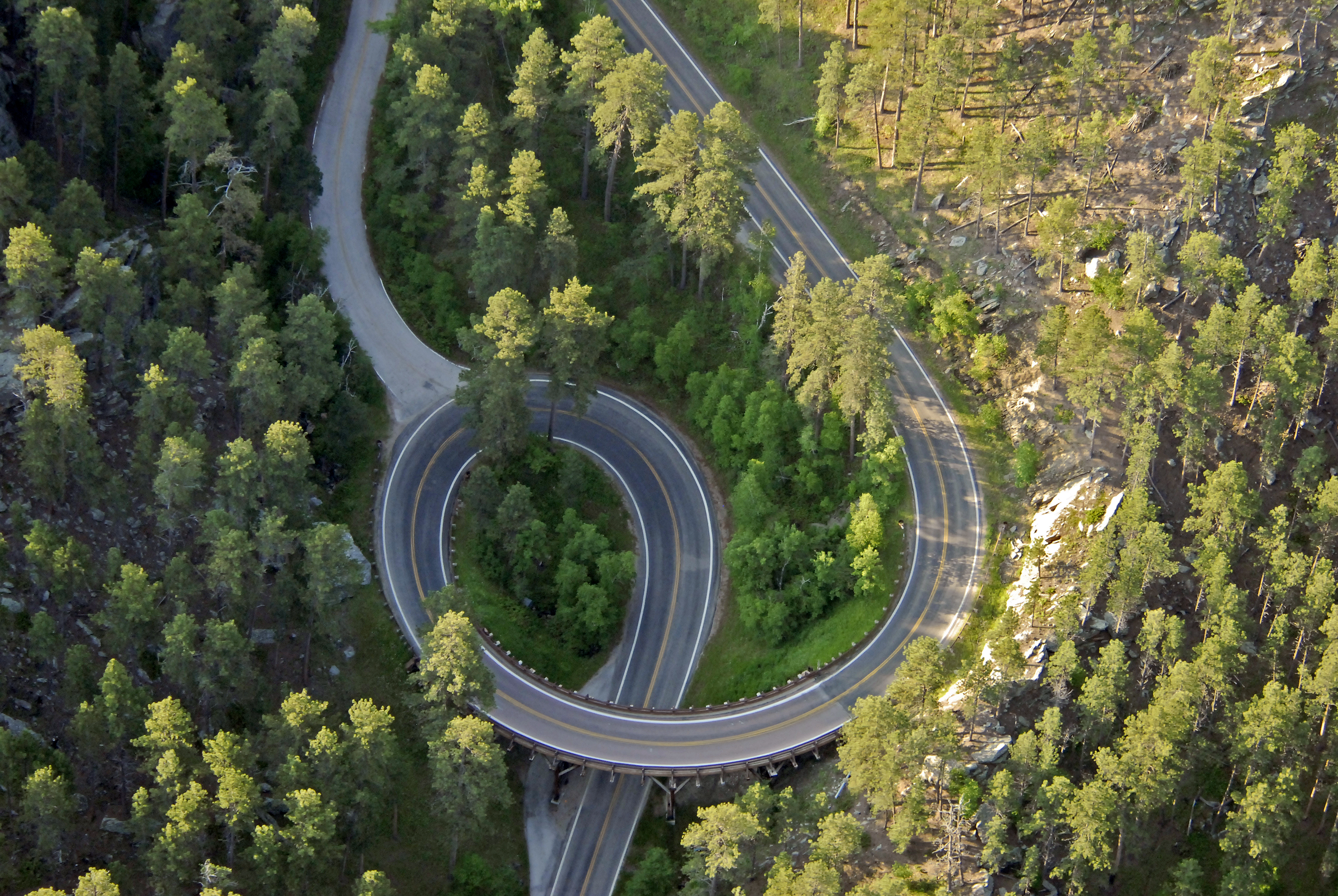
Expected travel time: 60+ minutes
Tunnels:
Doane Robinson Tunnel, 12' 0" wide by 11' 4" high;
C.C. Gideon Tunnel, 11' 6" wide by 10' 9" high;
Scovel Johnson Tunnel, 10' 9" wide by 11' 0" high.
The Iron Mountain Road is a work of art in itself. The highway connects Custer State Park and Mount Rushmore National Memorial and passes through some of the most beautiful scenery in the Black Hills, including three tunnels that frame Mount Rushmore in the distance. The road is famous for the "Pigtail Bridges" that allow travelers to drop or gain altitude quickly.
The highway was constructed in the 1930s under the direction of Governor Peter Norbeck, "this is not meant to be a super highway, to do the scenery justice you should drive no more than 20 mph and to do it full justice you should simply get out and walk." Experience the road that engineers once said couldn't be built; you'll be happy you did.
Iron Mountain Road does close periodically during the winter depending on conditions and how quickly the road can be cleared safely.
Wildlife Loop Road
Expected travel time: 1 hour 30 minutes—travel time is dependent on “wildlife jams”.
From the intersection of Wildlife Loop Road and SD Hwy 87, US Hwy 16A is five miles north.
Wildlife Loop Road twists and turns its way through the prairie and ponderosa pine-studded hills that harbor many of the park's wildlife species. On most days, guests will come face to face with the number one inhabitant of the park, 1,350 free roaming buffalo. White-tailed deer, mule deer, and elk are most visible early in the morning and late in the afternoon; if you're lucky, you may see big horn sheep, burrowing owls, coyotes, or even a mountain lions. Two of the most colorful characters along the way are the prairie dogs and a band of the park’s feral burros.
When to travel: The best time to view animals along the Wildlife Loop Road is early morning or late in the evening, just before sunset. The road is open year-round but does require careful driving during winter conditions.